Fall rain slows corn harvest as drought eases in some U.S. regions and worsens in others.
Fall Rain Delays Corn Harvest as U.S. Drought Conditions Shift
Share


Fall rain has delayed the U.S. corn harvest, while soybean harvest remains ahead of its five-year average. Drought has eased across much of the Corn Belt but intensified in the lower Mississippi Valley and Great Lakes region. University of Nebraska Extension meteorologist Eric Hunt explains the unusually warm fall and the outlook heading into winter.
Transcript
This fall’s weather pattern was dominated by rain and warmer weather.
A delayed harvest in 2026 began after extended rains in September were followed by more precipitation over the last two weeks. USDA’s harvest numbers on Tuesday put the pace five points behind the 5-year average to 86% complete. Soybean harvest is actually ahead of the 5-year average with 92% of this year’s crop in the bin.
Eric Hunt, University of Nebraska Extension Meteorologist: “I think the bigger story this fall really has been how consistently warm has been almost everywhere in the country, especially between the Rockies and the Great Lakes. Most places are record warm or near record warm for average temperature, and minimum temperatures have been even more exceptional.”
The big discussion point for row crop producers this year has centered around El Niño. The impact on North America has been seen through higher than normal amounts of precipitation this fall. Across South America, there’s the potential to have a drier growing season in December and January.
Eric Hunt, University of Nebraska Extension Meteorologist: “We have seen a steady upward trend in temperatures as the planet warms, but the record strong El Nino is supercharging the warmth so far this fall. And I think there's expectations that we're probably going to see that warmth continue as a general, particularly for the northern US as we head into the winter months.”
The Drought Monitor issued this week revealed nearly 67% of the continental U.S. is in some form of drought while much of the Corn Belt has left those dry conditions behind. The biggest improvement was seen in the Southwestern and Southeastern portions of the country. However, drought conditions intensified throughout the lower Mississippi Valley and over the Great Lakes.
Eric Hunt, University of Nebraska Extension Meteorologist: “That basically equates to drought levels that you should see about one or two out of every 100 years. I mean, this is basically a worst-case scenario type of drought down there, and a lot of that degradation has occurred in the last three months.”
Some of the areas expanding in drought missed fall moisture that can at times come from hurricanes. This was the first time since 1925 that there was only one named hurricane for the entire Atlantic season. The formation of Isaias was the latest named hurricane, in 121 years.
For Market to Market, I’m Laurel Bower.
Watch More
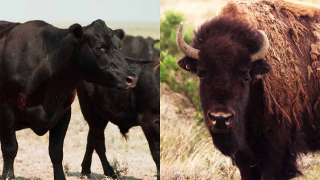
American Prairie's bison grazing permits face a legal challenge over use of federal land in Montana.
Kristi Van Ahn weighs China's soybean buying, corn's search for a bottom and the cattle rally.
Bison grazing permits face a challenge as rain slows corn harvest and China buys U.S. soybeans.
Kristi Van Ahn discusses grain sales, basis opportunities, 2027 planting and cattle risk.

A new group is looking to get the same tariff carve-out for UTVs and ATVs that e-bikes and motorcycles received, saying it would save producers thousands per vehicle.
Warming waters push lobsters farther north, forcing fishing families to travel farther and spend more to bring in their catch.