Jim Roemer explains why a rapidly strengthening El Niño — paired with record heat baking Western Europe's corn crop — points toward a neutral-to-bearish summer for corn and soybeans, not a repeat of the historic 1983 Corn Belt drought.
Weather's Role in Chasing 4th Consecutive Year of Record Crops
Share


Following a hot week in the Corn Belt, meteorologist Jim Roemer is on the line to talk about what a rapidly strengthening El Niño means for corn and soybean prices this summer. Roemer, who runs the Weather Wealth newsletter and the new Climate Intelligence Substack, walks us through a stack of charts comparing this year to 1976, 1983, 2015, and 2023 — the years his models say are the best analogs for the record heat now baking Western Europe. He explains why record-warm oceans and a shifting Atlantic conveyor belt, not just El Niño, are behind a European corn crop that could come in 8 to 15% below trend, why the wheat crop mostly dodged the damage, and why none of it looks like a repeat of the historic 1983 Corn Belt drought. Along the way: the lingering price fallout from the Iran war and fertilizer scare, a four-year streak of record U.S. corn yields that may be historically unprecedented, and a Texas and Oklahoma cattle drought that won't truly break until fall.
Transcript
YEAGER: I just walked in from it — it's about 106 heat index here in Iowa. Jim Roemer is our guest this week on the MTM podcast. The guy needs no introduction, but we haven't talked to him in a couple of years. Good to see you, Jim.
ROEMER: Great to see you too, Paul. It's been a long time. I miss Iowa — all my friends back there. Hopefully you'll come visit sometime soon.
YEAGER: If you'd just bring your air conditioner, I think you'd have a lot of friends here. It's pretty warm.
ROEMER: It's warm down here in Florida too. I moved to the East Coast about 15 years ago, and between the record warm ocean temperatures the last few years and record warm weather in Europe right now — hopefully parts of the Corn Belt will begin to cool off a little more toward normal after the Fourth of July weekend.
YEAGER: When we talk to you, it's always about the connection between weather and the commodities. You're a meteorologist and a commodities guy — you have a passion for both. You mentioned two things you're doing right now: Weather Wealth and Climate Intelligence. Let's get your promotion out of the way first.
ROEMER: There's so much information out there, and people get overloaded. I try to refine it. Weather Wealth has been a newsletter for seven or eight years — coffee producers, Midwest grain farmers, natural gas traders all over the world use it. It's not just weather forecasts, it's trading ideas and hedging. It's fairly expensive, but it helps a lot of people. Climate Intelligence started about two months ago — it's on Substack and it's inexpensive. One trade idea alone, like being bearish corn during all the hype over the Iran war a month and a half ago, pays for a year or two of it. It helps farmers make better business and trading decisions.
YEAGER: When you type the letter "E" on your keyboard, does autocomplete just go straight to El Niño on everything you write?
ROEMER: Just about. But there are other teleconnections besides El Niño that matter a lot for summer forecasts for Midwest grains and global ag commodities. There's a lot of hype about El Niño right now — it's strengthening very quickly. Unlike 1983, when we had a super El Niño that weakened, we could see the ridge build north and create one of the worst droughts in decades. Hopefully that's not the setup this summer.
YEAGER: Let's start with the first graphic. Only four El Niño events out of twenty had very hot June weather in Western Europe. You've charted 1976, 1983, 2015, 2023, and now this year.
ROEMER: We're having a huge ridge developing over Western Europe — European corn prices are up about 30% in the last two or three weeks. Usually these heat domes and droughts in Western Europe happen during a neutral or even La Niña pattern, so why is this happening now? It has to do with the Atlantic Ocean conveyor belt — the changing currents, which I think is partly climate change and melting sea ice, and the salinity of the North Atlantic changing right now. So we're having a fourth El Niño event with record warm weather and drought developing in Europe — but 2016 and 2020 also had heat waves in Europe in June and July without an El Niño. So the years we're comparing are 1976, 1983, 2015, and 2023. Can we draw comparisons? If we get this ridge pattern, what happens in the Corn Belt in July and August for pollination and soybean pod-setting? Some of those years had really bad droughts, like '83 and '76. We escaped a major drought in 2015 — that was an excellent crop year. So we look at everything, not just what's happening in Europe, but weather patterns elsewhere and how fast El Niño strengthens, to build our forecast this summer.
YEAGER: I watched some video before we recorded. Everywhere in Europe, people without air conditioning are trying to stay cool. How hot is it there compared to normal, and is one spot hotter than others?
ROEMER: I spend some summers with my girlfriend in Germany, or in France — most of those countries don't believe in air conditioners. It's been over 103 degrees in Paris, and parts of Barcelona over 100, when normal highs are in the mid-to-high 80s this time of year. It's a combination of factors — we don't think it's purely El Niño, it has to do with the change in the Atlantic conveyor belt, the Gulf Stream, and other factors.
YEAGER: We'll come back to the conveyor belt. France has diverse agriculture — we think of corn and wheat there. What's the outlook for their crops?
ROEMER: I think the corn crop will be one of the worst — maybe 8 to 15% below trend, similar to 2003 or 2006 when Western Europe had a crop problem. The wheat market has been fairly quiet the last five or six weeks, because it's too late for the drought to really hurt the wheat crop. Even though we had a drought in the Plains and a spike in wheat back in April and May, Australia's weather is improving, the spring wheat areas of Canada are doing well, and Ukraine has different moisture. So even though people thought the drought might hurt Europe's wheat crop — one of the top wheat producers — it's too late for that. It's really hurting the corn crop right now.
YEAGER: What does that mean for Asia and Africa — does it open the door for U.S. exports to fill the gap left by damaged crops?
ROEMER: There's a lot of irrigation in China, and you can't always tell what they're doing from one day to the next between weather, policy, and acreage expansion. But some El Niño events do bring problems to parts of China, like the North China Plain. That would be good news for American farmers if this El Niño strengthens, depending on how much irrigation those provinces have. It could open up export channels we really need after the tariffs and everything else — but probably good news after our harvest this fall.
YEAGER: Let's go to the next graphic — a comparison of years: 1976, the severe 1983 Corn Belt drought, and a weakening El Niño. Walk me through these trend lines.
ROEMER: This is a chart of corn and soybean prices. In 1976, upper left, we had a rally in soybeans in June and early July from some planting problems and drought conditions, then both corn and soybeans moved lower in the second half of the summer as the dryness eased. In 2023, we had a flash drought and a spike — blue is soybean prices, red is corn — wheat spiked in June 2023, then the market broke 10 to 20% the rest of the summer. Those are El Niño years we think are the best fit. We included 1983 in the upper right to show what a strong, weakening El Niño can look like. Most strong El Niño years are more like 2015, lower right, which was strengthening into summer, not weakening — and we went into a bear market in July and August that year. Looking at these three charts, the trend — and this would be the fourth summer in a row — points from neutral to probably bearish prices for most of the summer.
YEAGER: I keep looking at 2023 because it's closest to us, but it may mirror what we saw around Mother's Day this year. The market seems to be putting in its seasonal high earlier — June 17th or 18th this year isn't that different from a mid-May peak in 2023. Is there a correlation, with the market topping out earlier?
ROEMER: The difference, Paul, is that in 2023 we had a weak-to-moderate El Niño and some teleconnections tied to the North Pole that brought a really dry May and June — about half of normal rainfall over a good part of the Corn Belt, with some 90-degree heat in June. This year is different — we have great soil moisture. That's a big difference.
YEAGER: Let's move to the next chart — the Corn TCI Impact Selector. Some regions are red, one is yellow. Any significance to the colors?
ROEMER: This is my program tracking teleconnections. The area marked "1" is the Midwestern Corn Belt, particularly the western Corn Belt. Upper left is the Arctic Oscillation — what's happening over the North Pole. There's also the Atlantic index, tied to ocean temperatures across the central Atlantic. I look at all these teleconnections, not just El Niño, to build the summer forecast. One of the most important right now shows a negative 0.67 correlation on what's called the Pacific Transition Index — the jet stream at about 15,000 to 18,000 feet that runs from Asia across the North Atlantic and up across Siberia. When that index is negative, you get a ridge over Western Europe, like we're seeing now, and on average a northwest flow over most of the Corn Belt in July. So other than the heat over the next few days, July may bring a northwest flow, with the main heat dome sitting southwest of the Corn Belt — generally decent weather. I think that's a somewhat bearish scenario for corn and beans in July.
YEAGER: The market seems to agree with you — it's been acting that way. Sean Hackett said something similar in a recent episode: if the heat lasts five to seven days, the market says "talk to me in 10 or 14." That's when it responds. Reading this morning, there are chances for rain in a lot of places, and traders don't think that adds up to dry conditions.
ROEMER: You're right. In 2023, the El Niño developing right now is much stronger. If we'd had that dry, hot spring this year — which we didn't, given the Iran war a couple of months ago and all the fertilizer issues — we'd have seen $6 corn a few weeks ago. But the war ended, and most of the Corn Belt has forecasts for good rain. It's unusual to have four or five back-to-back record corn and soybean yields. I'm tempted to think we'll have a few weather scares but end up close to normal. And normal now is a lot higher than it was 10 or 20 years ago — it's still a really good crop, and that's what the market is looking at. We have enough supply right now. We'd really need China dryness from El Niño, and then a legitimate drought in Argentina and southern Brazil during a following La Niña, not El Niño, to get a major bull market in grains.
YEAGER: Sean also thought that if El Niño builds in North America, it causes problems in South America the following year. You're saying that might be delayed?
ROEMER: Typically an El Niño between December and February brings good weather to Argentina and southern Brazil — some northern areas might see stress, so soybean yields there could come in a bit below trend. But if you look back at the real bull markets of the last 10 to 20 years, they happened during La Niña, when Argentina and southern Brazil had major drought — like 2011, and then again the following summer. So a La Niña that hits Argentina, southern Brazil, corn and soybean production, followed by more of the same the next year — like 1976 — gives you a double whammy of multiple countries with problems.
YEAGER: Let's move to your U.S. summer corn and soybean weather recap — five charts within a chart, summarizing where we're headed.
ROEMER: These are the climate factors that will influence our weather. Upper left is the rapidly evolving El Niño — typically, if it's strong by summer, other than 1983, it tends to be cool and wet, even though it's strengthening fast right now and acting more like a weak El Niño. That means we could have a few weather scares, and August may be a little drier and hotter — something to watch for soybeans unless it strengthens. July looks relatively good. Global Angular Momentum is another indicator of how fast El Niño is forming — that's about torque in the atmosphere. Then there's the Indian Ocean Dipole — warm near Indonesia and Australia, cool off the coast of Africa — which can bring occasional warm spells to the Midwest, but nothing like 1983. Right now we have El Niño with a positive Indian Dipole, which tends to create droughts in parts of Southeast Asia affecting sugar, and has a big impact on coffee production in South America. The Antarctic Oscillation — a big vortex sitting over Antarctica — is the reason there won't be a freeze for Brazilian coffee over the next couple of months, and it tends to bring an occasional cooler, wetter Midwest in July. So I don't expect extreme heat and dryness for July based on most of these teleconnections. Fifth is the negative Pacific Transition Index — the jet stream from Asia across the Pacific and North Atlantic — which is so negative right now it's creating the huge ridge over Western Europe. I look at all these teleconnections together to build a forecast.
YEAGER: Of course it's complicated — if it were simple, I wouldn't need you, Jim. Let's go to the Pacific Transition Index specifically. Tell me what the index is.
ROEMER: It has to do with the jet pattern, covering about 10,000 to 15,000 miles. When the Pacific Transition Index is negative, you get a loopier jet stream — a northwest flow, occasional fronts, occasional squall lines for the Corn Belt, and any heat spells tend to be relieved by more normal temperatures. But you also get a ridge building off the coast of Spain and into much of Western Europe. That's what a negative PTI looks like, and usually with an El Niño it brings decent weather for the Corn Belt — that's what I'm watching right now.
YEAGER: Let's go to another chart — July 2015 temperatures, for comparison.
ROEMER: The difference between July 2015 and today is that by July 2015 we already had a super El Niño; right now it's weak but developing quickly, with positive Global Angular Momentum and other factors. I think it will strengthen further by fall or winter. As for the 2015 analog, it could impact global grain production in South America, but putting it all together — the negative index creating the ridge over Western Europe, the vortex over the South Pole preventing a freeze for Brazilian coffee, and El Niño forming — we'll see the drought and heat continue in Western Europe in July, while the Midwest stays mostly normal to cool. There may be some warmer-than-normal pockets in the Delta or northern Plains and southern Canada, but I don't see an extended stretch of mid-90s heat. Any heat should be short-lived, based on all the teleconnections in my program.
YEAGER: The next chart also shows dryness in the far northern Corn Belt and the Delta — a continuation of that pattern. Let's move to the 2015 comparison, which seems like the best match — corn in November, beans in 2015.
ROEMER: You can't draw a direct one-to-one correlation with any single analog year — you just get a general idea. The oceans have warmed, the Arctic has melted, and El Niño events are more frequent, so there's an element of chaos theory here. We had a spike around June 30th into early July in 2015 — some dryness and heat in parts of the Corn Belt, drier soils — but nothing lasting more than a few days. After July 10th to the 14th, we had about four or five weeks of normal, cool weather, with a little dryness in the northwest Belt but not enough for major concern. I don't have a lot of hope, unfortunately, for a major bull run at this point.
YEAGER: I should have had you define this earlier — you've said a couple of times we're not in a super El Niño yet. What is a super El Niño?
ROEMER: It has to do with ocean temperatures from Peru across to east of Australia being at least about three degrees Celsius warmer than normal. We're seeing that developing near Peru right now. It also involves the Southern Oscillation Index, Global Angular Momentum, and other teleconnections tied to the trade winds that create our weather. During La Niña, trade winds blow from east to west across Peru into the central Pacific, bringing up cool water and sometimes creating droughts in the Midwest and in southern Brazil and Argentina. During a super El Niño, those trade winds essentially stop. That can be devastating — the anchovy catch off Peru collapsed in 1972-73, and there was incredible global demand for soybean meal to replace it as cattle feed. That was really the first major documented El Niño, and it had a big impact on the Consumer Price Index and commodities broadly. There were no trade winds, no upwelling of cool water, and billions of fish died off Peru. Cattle farmers and soybean meal and oil users around the world scrambled to find supplement, and that's a lot of why soybean meal skyrocketed. It was the first documented super-strong El Niño that created an inflationary spiral — not just in soybean meal but in commodities like cocoa and coffee. El Niño has been in the spotlight ever since, for the last 40 to 50 years.
YEAGER: You could dip a toe into inflation and commodities today with a similar setup, minus the anchovies dying — we already have a head start there from other factors you've covered. I'm not going to let you fully answer that one, we'd both get in trouble. Let's move on — some forecasters think we're headed for a dry July. Why do they believe that?
ROEMER: Some of the models point that way — models can often be wrong, and a lot of them were calling for drought last year that never happened because La Niña didn't fully develop. I try to use the teleconnections we've discussed instead. My best guess is that this will be the first year with some areas of dryness — we're already seeing dry pockets developing in the northwest Corn Belt, even with some short-term rain there. That happens occasionally in El Niño years — 1976, 1983, and 2023 all had some dry spells, but it wasn't a total disaster with zero rain and 10 to 15 degrees above normal like 1983. I don't think we'll see that kind of extensive heat. There could be some spotty areas of concern in the northwestern Corn Belt over the next few weeks, but I don't think it's going to be a disaster.
YEAGER: We'll skip the next chart since it covers dates that will have already passed by the time people see this. Let's go to U.S. corn record streaks and fourth-year outcomes. You mentioned this earlier — adding record on record on record.
ROEMER: If you know of any other stretch with three or four record corn crops in a row, let me know — there have only been a couple of cases in the last 40 years. Statistically it's not that common. Look at 1988: yields came down from the previous record by the fourth year, but that was a La Niña, so it doesn't really apply here. 2003 through 2006 — 2006 was a weak-to-moderate El Niño, and there was some dryness in the western Corn Belt, some concern, but huge yields in the central and eastern Corn Belt meant the final number, 149.1 bushels an acre, was still relatively strong. So it's possible we see some dryness here or there later on, with western and northern Corn Belt yields not as good as central and eastern — but on average, I'm not looking at a crop 5% below trend. Maybe right at trend line this year instead of well above it.
YEAGER: My father would ask this — could this just be genetics? That's why we've withstood weather better the last few years. If you compare hybrids from the mid-80s to 20 years ago to now, there's a lot of change.
ROEMER: Trend lines have absolutely jumped because of genetics — these hybrids from Pioneer and others are a huge difference from when I was living in Iowa after college in the '80s, when one week of warmer temperatures and a weather scare could send corn up 30 cents and knock yields down significantly. Warm nighttime lows used to really hurt corn yields — daytime highs in the 80s and low 90s with a little rain were no big deal, but nighttime lows in the 70s could knock off 3 to 5 bushels easily 15 or 20 years ago. So yes, genetics has made a big difference.
YEAGER: We've been able to withstand more for longer. Let's look at August — western and eastern Corn Belt. North of the Ohio River has had ample moisture, west of the Missouri has not.
ROEMER: For August soybeans — if this El Niño strengthens, not just near Peru but across the central Pacific, to more than 3 to 3.5 degrees above normal by late July and August, and if the trade winds die off enough that the Southern Oscillation Index goes strongly negative, that tends to produce a normal-to-cool August, which would probably save the soybean crop — unless July turns drier than normal. If we stay weak-to-moderate El Niño, that opens the door to some occasional dry spells and heat, and maybe a bit of a rally in August. It depends on what the Pacific Transition Index and the Indian Dipole do, along with the other teleconnections that affect our Midwest weather, not just El Niño. It's still somewhat of a guessing game. I was very confident in April and May the last two summers, and we got record crops and good weather. I'm less sure this year. Some people don't believe in climate change — I do. I live in Florida; I moved here 15 years ago, and the oceans were never above 92, now they're pushing 100. The Arctic is melting. That affects how much the jet stream curves and dips, and how much northwest flow we get. Weather is chaotic — only one entity has a monopoly on it. Things can change quickly. If we don't have a super El Niño by August and it stays weak-to-moderate, we could see a few problems in the Corn Belt in August. It's possible.
YEAGER: What does that mean for prices?
ROEMER: If we get a warm, dry July or August, especially with more longs forced out of the market now that the war has ended and the crop looks decent in late June and early July, you could see a 5 to 8% rally in soybeans, maybe 10% the next month — not the 20 to 30% you'd get with La Niña or the infamous 1983 El Niño, the hottest August on record, when a super El Niño weakened so rapidly it built that Midwest heat dome. I don't think that's going to repeat. We could see a few areas of dryness and some hot spells, but a consistent four-to-five-week dry stretch is probably limited to parts of the western and northern Corn Belt in August, not the entire Corn Belt.
YEAGER: I'll be calling you in mid-August if I'm at the Iowa State Fair dealing with 1983-like weather.
ROEMER: I'll fly out — I need to see some old friends from Freeze Notice anyway, from 30 or 40 years ago.
YEAGER: That was on our bingo card for this conversation — make sure we mention Freeze Notice. You've talked about corn's consecutive record years — what about soybean yields after three consecutive record crops?
ROEMER: There's not a lot of data — really just one comparable case, so it's difficult to say with confidence. Four consecutive bumper crops seems unprecedented to me, though I'm sure there were stretches before 1980 or 1990 with three or four record years in a row. Statistically it seems unlikely to continue, though hybrids and technology keep improving, which is probably the only reason we've gotten four consecutive years. I think El Niño probably won't reach "super" status until September or October, which opens the door to some risk for soybeans in August — not a disaster, but probably not a fifth consecutive record crop.
YEAGER: Let's close with two things. First, Texas, Oklahoma, and New Mexico — the drought there, and cattle country specifically.
ROEMER: We've had a multi-year drought there dating back a couple of years. Parts of Houston have had severe weather and tornadoes but not real drought relief, though that's away from the main wheat and cotton areas. Ranchers from Lubbock north to Amarillo haven't seen as much of that severe weather or tornado activity. Typically, with El Niño forming, droughts that already exist — and this one's tied to a lingering La Niña — tend to ease slowly. Looking at the charts, October through December tends to be wetter, maybe even some snow by December, for most El Niño years that were strong by late summer. But the drought situation likely doesn't really improve until fall and winter — probably October through December.
YEAGER: So that doesn't sound like conditions for expanding cattle herds right now.
ROEMER: No, it's not — but ranchers should get some real relief this fall and winter, and that could support herd expansion in 2027 if El Niño continues into next spring and summer. That's a real question mark — it's possible we could see a 9-to-16-month El Niño that lasts into the summer of 2027. If that happens, we could see some of the best grassland and pastureland conditions in several years, maybe half a decade, later this year and into spring 2027.
YEAGER: How do we know when El Niño is over — within a week or two, based on temperatures off Peru?
ROEMER: You look at what's happening with crops around the world — sugar cane areas in Thailand and India that tend to have drought start getting rain, South American weather changes — but mainly it comes down to ocean temperatures cooling along the equator as the trade winds, which had weakened blowing from Peru into the central Pacific, start to reverse. Cooler water starts coming back up, the anchovies come back, and if that persists more than two or three consecutive months, El Niño is effectively dead. It's a little early to predict exactly when. Most El Niño events last 6 to 10 months, some longer — we've also had stretches of two or three years of La Niña, like 2010 to 2012. Could we get two or three years of El Niño through 2028? That's only happened once or twice in the last several decades, and I'd need to check my research — but if it happened, it would be inflationary, particularly for soft commodities like cocoa, sugar, and coffee, and could reduce South American soybean production, especially in Brazil, more than Argentina. It's rare for both northern Brazil and Argentina/southern Brazil to have drought — or record crops — at the same time. This past season, as we transitioned from La Niña to neutral, South America had huge crops, which is part of why soybean prices dropped about 10% — that, plus the end of the trade tariffs situation, but also because South America hit a big crop again this year during that neutral transition.
YEAGER: Let's do the last thing — the two headlines you'd want people to take away from where we stand right now, in July of 2026.
ROEMER: I think we're looking at occasional dry spells in the western through northern Corn Belt, but because the Pacific Transition Index is negative and building this dome over Western Europe, with El Niño strengthening, the odds favor the main heat dome sitting over the southwest U.S. — occasional dryness in the western to northern Corn Belt, but not extreme, sustained heat for August. That could shift. 2015, one of my best analog years, was generally drier than normal in parts of the Corn Belt in August but stayed cool. If El Niño strengthens to "super" like it did by 2015, we may see some dry weather in the western through northern Corn Belt, but it probably wouldn't be a hot August — more normal to cool, which would keep us in a bear market. If El Niño doesn't become super by August and stays weak-to-moderate, that opens the door to some occasional crop problems and a possible reduction in the soybean crop — but a major disaster, 5 to 10% below trend with eight weeks of hot, dry weather like 1983, probably isn't going to happen. 1983 is one of the only El Niño years I can find with a severe July-and-August Midwest drought. I lived in Iowa and remember it — I was 24, riding in combines, talking with great farmers. That was a rare case of a super El Niño weakening so rapidly that it built a ridge into the Midwest. Mostly it's La Niña events that create droughts and bull markets for the grain belt in summer, and we've been fortunate the last couple of years with good crops.
YEAGER: May the odds always be in your favor, Jim Roemer.
ROEMER: The Fourth be with you.
YEAGER: The Fourth of July to you as well. You can read more from Jim at Weather Wealth and Climate Intelligence. Always a pleasure, Jim.
ROEMER: I don't know how intelligent I am, but thank you. I've been doing this for 45 years — always exciting, always interesting. Good luck to everybody out there, I hope you have a good summer, and we'll pray for higher corn and soybean prices, as long as you get rain and cooler temperatures.
YEAGER: All right, Jim, thank you. We are produced at Iowa PBS. Our production supervisor is Sean Ingrassia. His crew is Reid Denker, Kevin Rivers, Julie Knutson, Neil Kyer, and David Feingold. The executive producer of Market to Market is David Miller. I'm Paul Yeager. We'll see you next time.
Watch More
Higher USDA yields pressure grain. Plus, opportunities/costs of putting local food on school trays.
How grain prices rally this winter w/Naomi Blohm & Ted Seifried on USDA, China demand & S. America.

An Iowa school district connects local farms, food hubs and students through the lunch tray.
Naomi Blohm and Ted Seifried question USDA’s corn yield surprise and weigh China’s soybean demand.

Farmers rarely seek mental health help. Farm Dog offers care from people who know farm life.
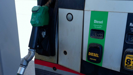
Rising diesel and freight costs squeeze farm margins and could reshape plans for the 2027 crop.