Summer extremes of isolated heavy rain, wildfire haze and drought are all in play this growing season. Meteorologist Eric Hunt from the University of Nebraska shows us maps and more happenings this season.
Corn and Soybean Yields Dependence on El Niño, More Impact This Winter
Share


The hot American summer is also happening in Europe. However, as the brewing “super” El Niño takes form, other countries’ impact will be different – and likely found – this winter. We also look at plant diseases spreading across Nebraska cornfields and the likelihood of other regions being impacted. Meteorologist Eric Hunt from the University of Nebraska walks through where drought has eased, where it's gotten worse, and why the heart of the Corn Belt has largely stayed out of trouble. He also covers tar spot's early arrival, a new insurance data set showing where yield-loss triggers might hit, and what a pattern shift next week could mean for corn and soybeans heading into pollination.
Transcript
Hunt: Good morning, I'm Eric Hunt and welcome to the MtoM podcast. Paul Yeager is the host, but I'm introducing the podcast again, I think.
Yeager: It works, Eric, when we do it this way.
Hunt: I enjoy it. I do it myself on my own podcast, so I'm used to it.
Yeager: You're the only one I do this with, because you do have that history of hosting things on broadcast. Before we go any further, where can we see you?
Hunt: You'll find me lots of places. If you're in Nebraska, you can find me on Market Journal on Saturday mornings on PBS at 7:00. If you're outside the state, or in western Iowa, you can watch Market Journal videos on YouTube — just Google “Market Journal YouTube” and it'll show up. The weather segments are usually available by Friday morning. The whole show is worth watching, as is Market to Market. In Nebraska we get Market to Market and Market Journal back to back — I'm not sure how that works. Market to Market comes on Friday evening in Iowa, right?
Yeager: That's when we originate, yeah. There are a couple of other states where it airs Friday too.
Hunt: We have a digital antenna in our attic, so we can actually pick up the Iowa PBS station. If we wanted to on Friday night, we could watch it.
Yeager: Or you can always watch it online — that's an option too, through our YouTube channel. What's the big topic everybody wants to ask you about? It's always the weather, but anything specific?
Hunt: Lots of stuff. It's been pretty warm across much of the country the last week or so. We've had record-setting ridge pressure across the north-central part of the country — the Minneapolis sounding had a 600-decameter reading earlier in the week, which doesn't mean much to most people, but for a meteorologist, 600 meters is very impressive. That's something you'd typically see more over the Southwest, so we saw very impressive levels of upper-level ridging in the atmosphere over the north-central country. We've been very warm and dry, and now we're starting to see smoke coming in — wildfire smoke from Ontario is starting to push south and southwest. So there are some real air-quality issues developing in Michigan, Indiana, Ohio, pushing into Illinois. I think we'll see some air-quality issues reach Iowa and Nebraska, but we'll miss the worst of it.
Yeager: I have a question — give me an English version of what that 600-meter reading in Minnesota means.
Hunt: On the sounding, pressure levels — like 850 millibars, 700 millibars, 500 millibars — are typically around 20,000 feet up. It's not quite cruising altitude, but the higher that height is at 500 millibars, or any pressure level, the warmer the atmosphere overall. So 600 meters means the atmosphere overall is incredibly warm. In the wintertime it could drop into the low 500s, or even the 520s to 530s range in this part of the world. Occasionally it'll dip closer to 500 during a severe cold snap, but 600 meters is very impressive. I think the only reason we haven't seen even higher temperatures is that the mixing hasn't been that substantial — we haven't brought down extremely warm air and pushed temperatures into the 100s across a large section. We've been in the upper 80s and 90s over a large area, with some 100s across portions of the northern Nebraska Panhandle, the Dakotas, and eastern Montana. But it's not like 1936 — we had a comparable ridge that year, with temperatures well over 100 degrees across a large portion of the continent.
Yeager: We have a comparison coming up in the slides — we'll get to that in a minute. Is this setup a heat dome?
Hunt: You could call it a heat dome. A heat dome is basically a strong upper-level ridge with a lot of heat built in. In summer, a ridge always brings warmer-than-average temperatures, but we tend to call them heat domes because they're associated with heat waves. We're definitely seeing that across portions of the Northern Plains and Upper Midwest. Thankfully, though, a lot of the Corn Belt has just been warm this week, but temperatures have dropped off more at night than expected, and high temperatures have generally run a bit under forecast — low 90s, not ideal, but not necessarily the worst either.
Yeager: Well, it sounds like we're getting close to record global temperatures.
Hunt: We are — right now we're running just a bit shy of 2023. 2023 wasn't the warmest year on record overall — that was 2024 — but 2023 was the warmest for a lot of the latter part of the year, in large part because we were heading into a relatively strong El Niño in late 2023 and 2024. So we're warming at a relatively quick pace, but El Niño tends to add a little extra heat on top — a temporary extra fever. We're starting to see that now. Earlier in the year we were running below 2025; now we're running above the 2025 mark — that's the orange line and the darker gray line toward the top, which is 2023. My guess is we'll probably track close to that, and maybe exceed it, in the last half of the year. In 1982 we were heading into a very strong El Niño too — probably the strongest in the last half of the 20th century, and in my lifetime, probably in a lot of people's lifetimes. But the 1982 baseline was about 1.5 to 3 degrees Celsius cooler than where we are so far in 2026. So our temperatures are going to be much warmer than they were in 1982 and early 1983.
Yeager: I should mention, if you're listening to this episode, this is one of the visual ones — we just talked about the orange and gray lines on the chart. Then there's the near-record global temperatures chart, comparing June to the second half of the 20th century, and a different one on the right.
Hunt: The one on the left basically shows the upper-air 500-millibar anomalies for the month of June — that's how we pick out where the ridges and troughs were. If you're sitting under a ridge for a whole month, you're probably warmer than average. We had more of a trough over the Northern Plains, which is one reason we had more storming across the central US in June. We also saw temperatures that were relatively mild — we didn't have a lot of heat in the north-central US for most of June, which I'd say is the first time that's happened in about seven years. We did see significant heat in the eastern US in late June and early July, and some of that crossed into the Midwest as well. But really, the big story was across the pond — extremely high temperatures across a lot of western and northern Europe in late June, with a massive ridge centered basically over France. That created a lot of sinking air and warm air being pushed back down to the surface. We saw temperatures over 110 in parts of France — Paris hit 104, Frankfurt, Germany hit around 104 at one point in late June. They don't have much air conditioning over there, so hopefully they can start adding some, because they're seeing more intense summer heat. The figure on the right shows the 500-millibar height anomalies over the last ten summers — 2016 to 2025 — compared to the second half of the 20th century. You see a lot of browns and oranges, meaning heights are higher than they used to be, an indication we've warmed up. There are a couple of darker spots right off the West Coast and over Western Europe, so we've seen more heat in the western US than the eastern US in summer, and more heat in Western Europe. In large part, the atmosphere over the last ten years has been preferentially putting ridges over the western US and more trough activity over places like Iceland, but stronger ridging over Western Europe — so we've seen more heat waves there. My hunch is that trend continues: the western US warming up faster than the eastern half in summer, and continued heat waves in Europe.
Yeager: Yeah, if the World Cup had been in Europe, we really would have needed hydration breaks, not just like we had in the United States.
Hunt: Absolutely. I don't know why they wouldn't — you're running around a soccer field for 90 minutes, a hydration break makes sense whether it's 70 degrees or 100. It would have been a problem if the World Cup had been in Europe this year. Thankfully, here in the US, we had some really hot matches around the Fourth of July in the East, but by and large we were lucky — matches on the West Coast were generally fine with heat, and in June places like Kansas City and Philadelphia were getting by okay. But on the Fourth of July, Philadelphia hit 100 to 102 at kickoff, and the heat index was around 107. In Miami, for the England-Norway game, they're not really used to that kind of heat and humidity.
Yeager: And people are getting to experience our storms too — you mentioned this spring and June, and the Fourth of July weekend for me was ridiculous, and I know I wasn't alone.
Hunt: Yeah, you had a tremendous amount of rain for a couple of days in central Iowa. Hail reports in 2026 are actually below average, but wind reports are up — we've seen a lot of wind damage across the country this year, and in some places, a lot of tornadoes. Illinois has had a record number of tornadoes this year, and I believe they still have the most of any state. It's a continuing trend to see more tornadoes in places like Illinois, Indiana, Ohio, western Tennessee, and eastern Arkansas, and somewhat fewer in the Plains. But again, this is another summer where we've had pockets of a lot of wind and hail damage. In Nebraska, June 19th was bad news for the central part of the state — a lot of wind and hail damage. South Dakota may have set an all-time wind gust record in late June — 131 miles an hour near a town by Pierre, South Dakota. I might be mispronouncing the name, but it literally leveled wind turbines — took them straight down.
Yeager: Like toothpicks — yeah, I saw some of those pictures. Your blue line here is us right now in '26. Which dotted line is way above all the other norms on that graphic?
Hunt: That's 2011. 2011 is the gold standard for massive outbreaks of severe weather across a large portion of the country — not all at once, but that year we had the April 27, 2011 outbreak, a horrific event in Alabama, Tennessee, and other parts of the Mid-South and Southeast. I think that was also the Joplin tornado year, in May. We had a lot of wind and hail damage across the country in general that year — very active weather. We haven't necessarily replicated that since, and I hope we don't replicate that upper-level pattern anytime soon.
Yeager: Thursdays mean the Drought Monitor — the data cuts off Thursday morning, which is when we're recording this. So if you're watching this on Tuesday, we're talking about Thursday's data — a little behind the curtain there. What's the drought monitor picture, other than a lot more red?
Hunt: A lot more red — however, there's less red on this map than there was two months ago, which is good. My home state of Nebraska has actually seen a decent reduction in extreme and exceptional drought over the last six weeks. That's good. There's still a lot of drought in the West, and a lot of severe, extreme, and in some cases exceptional drought across the Southeast and Atlantic region — it's been incredibly dry in North Carolina, Virginia, South Carolina, and Florida. We've seen some decent drought improvement across parts of Tennessee and Mississippi. Right now the Midwest Corn Belt, by and large, is free and clear of drought, but there are areas I'm concerned about — portions of western Iowa and eastern Nebraska have been pretty dry the last 30 to 45 days, and it's been dry across the Upper Midwest, particularly Minnesota, where we've seen some pretty rapid degradation. We still see a lot of drought across the West. The active monsoon kicking in recently should help alleviate conditions in places like Arizona, Utah, Colorado, and New Mexico — but because they've been so dry, heavy convective rainfall can cause flash flooding, which is a concern.
Yeager: That's what you mentioned before we started recording, about California and certain cities — it doesn't rain much, and when it does, it's a problem. Let's move to the crop side of things. The last couple of times we talked, Eric, it's been about wheat conditions in Nebraska. That winter wheat crop is mostly gone, but the conditions haven't improved.
Hunt: Right, and my understanding is USDA lowered its production estimate even more — one of the lowest we've had in decades. If you look at this plot, from Geoglam — they have nice global crop plots for wheat, soybeans, corn, and rice — you can see a lot of orange showing very poor conditions across almost the entire Great Plains region. That's largely because of massive drought conditions over the western Plains this past winter and early spring. Some places have improved lately, but it was too late for this year's crop. In the Northern Plains, wheat conditions are considered better — the wheat in eastern Washington is considered exceptional. That doesn't offset what we lost in the central and southern Plains, but globally, a lot of areas where we grow wheat are doing okay. Other parts of Europe are generally fine. Turkey is considered exceptional. Wheat in South America isn't too bad either. So globally, wheat has been mostly okay elsewhere, which is probably one reason we haven't seen wheat prices spike like they did in 2010-2011, which were really high.
Yeager: For corn, I'm looking for “watch” and “poor” conditions and don't see much poor — just some watch conditions and a small part in Africa. What else do you see on the maize conditions map?
Hunt: This map is a little dated — I think it updates every 3 to 4 weeks — so I'd expect a bit more yellow across portions of the Corn Belt by now. But by and large there's a lot of green, meaning favorable conditions. I see favorable conditions across South America, other parts of Europe, and China — not a lot of areas globally where corn production is really struggling. The Caribbean tends to see more suppressed precipitation during El Niño, so there could be issues there. These figures also try to show the cause — in some cases it's not drought, it's socioeconomic or conflict-related, geopolitical issues causing problems in some regions.
Yeager: We do have corn and soybeans in drought on this next map, which looks more updated. What are we looking at here?
Hunt: The one on the left shows drought areas — where you see a red line means you're in drought, corn on the left, soybeans on the right. There's a large swath of the country in drought, but unfortunately for anyone wanting higher corn or soybean prices, it's not where the heart of corn production is. There are places in Nebraska and Iowa I'm concerned about, but by and large the dark green — the major crop area — is mostly free and clear of drought on both corn and soybeans, and I expect that to mostly continue for the next month or so. So the window for a big weather scare isn't gone, but it's not a huge window right now.
Yeager: Last week on the show, Ted Seifert said if we just peck away with a little crop stress, that could change yield and impact the market. So if I'm looking at Nebraska, South Dakota, and a bit of Iowa, it could happen — but that's like with Ted, “could” gives you a lot of flexibility.
Hunt: “Could” gives me a lot of flexibility — which meteorologists love.
Yeager: What about soybeans — same situation, the heart of the big green areas not under a lot of stress?
Hunt: Exactly right. There are places that could use a good rain, but I think rain is coming back here over the next week to ten days, and a lot of areas have had decent soil moisture to work with, so we've been able to get through this stretch of warm, dry weather. There are years we couldn't have afforded this dry spell, but this year I think a lot of us had enough reserve to get through it. We're not out of the woods — if it doesn't rain in the next ten days, you'll see some yield declines in certain places — but at this point I'm not seeing major drought as a real driver. Usually if we're heading toward massive drought issues, we'd already be seeing it play out over a large portion of the West by this point in July, and that's not really the case.
Yeager: We had a lot of moisture and humidity early, ripe conditions for last year's problem — tar spot.
Hunt: We've actually seen tar spot creep in pretty early this year across portions of Nebraska — a lot of reports, which we didn't see in the state until late in the 2020s. It presumably came in from Iowa or northern Missouri and has gradually spread west, making a strong westward push this year. We haven't seen as many reports elsewhere, but just because a county isn't listed orange doesn't mean it's not there — it just means where it's confirmed. In Nebraska especially, we had more anomalous easterly flow in the lower atmosphere during June, so we likely saw favorable conditions for it — more cloud cover, which we did see across the region in June, plus enough wetness and mild temperatures. Tar spot likes mild temperatures, not so much heat, so the higher temperatures we're getting now may actually be beneficial for keeping tar spot down. Warmer conditions are more favorable for southern rust — we're not seeing a lot of reports of that yet, but I'm suspicious it could come up in the next couple weeks because we've had persistent southerly flow from Texas and Louisiana, where it tends to originate. Folks on the Crop Protection Network in northern Kansas, Nebraska, Iowa, and Illinois are good about reporting it; further south, less so — so don't rely just on those reports. It may already be in the area. My recommendation — really, the plant pathologists' recommendation, which I'm just passing along — is to go out and look at your fields.
Yeager: Now you want to get into insurance a bit.
Hunt: Yeah, I ran across this figure on LinkedIn. I used to work for a company called Atmospheric and Environmental Research, at the time owned by Verisk Analytics. They had a team — I think by the time I left they were called Extreme Event Solutions — that does a lot of work for the crop insurance sector. They have a nice map showing where the Enhanced Coverage Option may kick in at 95% — meaning a 5% yield reduction at the county level, enough to trigger a payment. It shows parts of Illinois and Iowa where, for various reasons, that may kick in. In parts of Illinois, that's probably not a drought story — more likely a planting issue, since there's been a lot of excessive wetness at times. In parts of the Corn Belt, it's actually more detrimental to be too wet than too dry, which isn't usually our problem out here, but for parts of Iowa, Illinois, Indiana, and Minnesota, wetness is probably more of a problem than dryness.
Yeager: Let's look at pasture conditions — no surprise where the stress is.
Hunt: Right, like the drought monitor showed, the western half of the country generally has a lot of stress. This combines satellite vegetation reflectance with a long-term precipitation index — the nice thing about reflectance is it overrides precipitation indices that get skewed positive by a couple of big rain events. It's picking up stress pretty well across the Sandhills in Nebraska, Wyoming, and a lot of our rangelands. Conditions have improved a little in some places over the last month, but they're still generally pretty bad. Until these rangelands improve in a meaningful way over a long period, it'll be difficult to build herd size back up because there's simply not enough forage production. The figure on the right is the Forest Drought Response Index, and you'll notice extreme stress on forests across portions of northern Minnesota and a lot of the Southeast — similar conditions to those behind the fires that started in Ontario, which I think have crept into northern Minnesota, where there have been some fires. Fire danger in that area is likely to stay relatively high this summer unless we get more significant precipitation.
Yeager: And the drought outlook holds a similar story in similar areas?
Hunt: Yeah, this outlook is also a little dated — they release it late in the month — but they're expecting some improvement across the West. We're already seeing a relatively active monsoon in places like Arizona and New Mexico, so I think we'll see drought improvement there after a bad winter. But they expect drought to persist across most of the Plains, with more development expected in Texas — though Texas has been getting tons of rain the last few days, which may push that down the road. Still, there's potential for it to dry out and heat up there later. They're also expecting drought to remain relatively persistent across the Mid-Atlantic, with maybe some improvement in the Southeast and Northeast, but by and large we're still dealing with drought issues in the eastern US. I think we'll see continued improvement across portions of Nebraska, but for D2 and D3 areas, it'll be very difficult to be completely free and clear of drought by early October.
Yeager: There's been some precipitation in Nebraska, just not enough, and we mentioned central Iowa is spotty — but Missouri, Kansas, and Kentucky have been way above what they normally get this time of year.
Hunt: Yes, and some of those places were insanely dry earlier this year — at one point the Ohio River Valley was basically the line between who was getting moisture and who wasn't. Kentucky has done a lot better in the last 30 to 60 days, but there are pockets that have been very wet — parts of Kansas and Missouri have had a lot of precipitation. By and large, eastern Iowa and Illinois have had adequate moisture, but there are dry pockets like northern Indiana. I really want to point out western Iowa and northeastern Nebraska — they've generally been missing out on rain over the last month to six weeks, and I'm concerned they're fairly short on moisture. If we don't get decent moisture in the next 7 to 10 days — which is currently projected — I think we could be looking at something like a 2020-type event in that part of Iowa, where we saw some relatively big yield drop-offs.
Yeager: That's reflected a bit in the soil moisture too — we've talked about that a lot over the years, so I'll skip ahead. You see the water stress level in Nebraska and where there's adequate moisture, but you've teased that there's a pattern change on the horizon.
Hunt: Teasing, to some degree, isn't it?
Yeager: Yeah, it is.
Hunt: So I do think — right now the ridge has been very prominent, centered basically over Aberdeen, South Dakota, toward Minneapolis, for a lot of this current week. As we move through time, that ridge should shift south and southwest, back toward the Four Corners region, which opens up more storm-riding opportunities across the High Plains and into a lot of the Corn Belt. So the expectation next week is more routine chances of moisture, and right now the European ensemble shows above-average precipitation favored from Wyoming into western Iowa. I think there are opportunities in places like northeastern Nebraska, where we have more rain-fed corn, and western Iowa, to pick up some significant precipitation. This time of year, our rainfall is almost entirely from thunderstorms, so some places get a lot, some don't get enough, and sometimes the rain doesn't come in ways that help infiltration — so it doesn't necessarily mean a full profile of moisture comes back to a place like Carroll, Iowa. But it does mean we should get more precipitation overall. I think a lot of places that have been relatively dry are going to get chances at decent rain over the next week, and if they get it, there's a chance conditions stay pretty good in those areas. They're also expecting pockets of above-average precipitation across Illinois, Missouri, Indiana, and Ohio — not a lot of brown on the map, meaning near-average precipitation, so even though it's been dry lately, we should start seeing the faucet turn back on and hopefully stay on for a while. As long as we're getting chances of moisture every few days, that should set us up nicely through the rest of corn's reproductive phase, and it bodes well for pod-filling in soybeans.
Yeager: You mentioned Carroll — Carroll, Fort Dodge, and Cedar Rapids are three communities hoping this week, as this airs, that the rain stays away from 10 a.m. to 10 p.m. with no lightning within a 15-mile radius, so state softball and state baseball can be played — that's really all that matters, especially for the TV crew working Thursday and Friday this week. The heat is shifting south — I see Oklahoma, Texas, Arkansas, and Missouri getting their turn. On the outlook for storms — I'm flying through this because I need to get to the next thing — the CPC extended outlook shows temperature on the left, precipitation on the right. Anything on those two graphs, or can we keep going?
Hunt: Basically just showing that we're not expecting the heat to persist for a long period — a lot of the north-central country should see a better chance of moisture coming back into the region.
Yeager: Are you missing a word on the El Niño slide — where's “super” in front of it? Are we not in that now?
Hunt: We're not in a super El Niño yet — just a strong one. Right now there's a strong probability we'll be in a very strong El Niño by this fall or winter — possibly the strongest we've seen in over a century. There will be some global impacts.
Yeager: And those are?
Hunt: Most likely, major drought developing across portions of Indonesia and northern Australia — we're already seeing some dryness issues in India. The Caribbean is likely to be pretty dry, the southern US probably fairly wet, and parts of South America — western South America, which doesn't normally get much precipitation — probably quite wet as well. The most global impact from El Niño tends to come from around the Tropic of Cancer and Tropic of Capricorn, but it can affect the entire globe, including us here in the mid-latitude Midwest.
Yeager: What's going to be the biggest impact of El Niño, or a super El Niño, for the grain-growing areas?
Hunt: I think the biggest impact for us would be — generally speaking, the stronger the Niño, the warmer the winter. So I'd feel relatively confident saying this winter is likely to be pretty mild. Parts of the Northern Plains might be a bit cooler than last year, since last year was the warmest on record. But by and large, expect a relatively mild winter. Looking ahead the next couple of months, the models are struggling a bit with the upper-air pattern — for example, the European model has been bullish on heat and dryness in the central US in the seasonal timeframe, even though historically, heading into a strong El Niño like 1982, 1997, 2015, or 2023, we generally don't see the heat crank up for most of the Midwest and eastern US — it tends to stay south and west, and we generally get somewhat adequate moisture. Some places a little dry, some a little wet, but nothing in these composites screams major drought pressure for the central US — though I can't discount that solution entirely, it's just not the most favored outcome based on historical precedent.
Yeager: I threw a lot of graphics up while you were talking there — the isobars, the analog composite, the winter El Niño precipitation outlook — we covered all of it. Let me ask a couple of wrap-up questions, Eric. When we talk about the grain-growing states and regions — the heat this week, last week, and forecast, but also the cooler temperatures — how much are traders noticing that? Does it look like the commodities have already let out some of that weather premium based on these forecast changes?
Hunt: I'd probably assume so. I think warmer temperatures are still likely across the West, but as long as we're not consistently seeing lows in the 70s, I think yields still have decent potential.
Yeager: And generally, the weather looks like it can continue setting up the main corn and soybean growing regions for a good outcome?
Hunt: That's kind of what it looks like right now.
Yeager: Anything else we need to cover today?
Hunt: I think that covers it.
Yeager: Oh — we got one more thing. You mentioned the smoke.
Hunt: Oh, sure.
Yeager: The impact — I know last year that was something we talked about a couple of times. How has that impacted us, and does it shift into August? I know you mentioned its potential in Iowa — Minnesota has the fires themselves, but I saw Chicago had a lot of haze. Do we think the haze is going to be a story?
Hunt: My understanding right now is it's probably more of a 2- or 3-day story. If it persists for a long period, there'd be potential to reduce yields. Mark Licht has done some good research showing that during corn's early reproductive stage, you can see relatively non-trivial yield reductions if there's a lot of wildfire smoke aloft — but it has to be relatively persistent. I don't remember the exact stage, but there was a stage where sustained smoke reduced yields by around 10% — don't quote me exactly on that number, but the reduction was real and noticeable in their studies.
Yeager: I always find it fascinating — that's why I keep calling. It's always changing in the middle of the growing season. Always good to get an update from you, Eric.
Hunt: The good news this week is a lot of places have been dropping more at night than expected — lows haven't been optimal, but they haven't been terrible. Mid-to-upper 60s is a lot better than mid-to-upper 70s. We've seen more of that heat pushed further north. We've had some warmer days, but that larger diurnal range isn't terrible for corn as long as you have moisture — you don't want highs in the low 90s and lows in the upper 70s for two weeks straight, because that combination really increases respiration. Just like humans don't sleep well when it's really warm, corn and soybeans don't like really warm overnight temperatures either. The fact that we've been able to drop a bit more at night than anticipated has been useful, and I think in the places that have had moisture, pollination has been pretty good — we've had cooler nights, a nice breeze without too much wind, and a wide range from the mid-60s to low 90s.
Yeager: I can tell you the one who has to go to football practice at 6 a.m. doesn't think it's been very cool in the early morning hours — he'd like to talk to you after we're done, Eric.
Hunt: That's okay.
Yeager: All right, Eric, great to see you. Follow him on Market Journal Saturday mornings, also the Crop Watch podcast — he's also with the Nebraska State Climate Office at the University of Nebraska. Great to see you, Eric, enjoy the rest of your week.
Hunt: Thanks as always, Paul.
Yeager: We're produced at Iowa PBS. Our production supervisor is Sean Ingrassia. His crew is Reagan Kaiser, Kevin Rivers, Julie Knudsen, Neil Kyer, and David Feingold. The executive producer of Market to Market is David Miller. I'm Paul Yeager. We'll see you next time.
Watch More
The window to sell old crop is looking good right now and there’s a big event happening July 19 as Naomi Blohm talks about in Market Plus.
A big sell-off in cattle with several grains and the significance of the 100 day moving averages for corn, wheat and soybeans with Naomi Blohm in our Market Analysis.
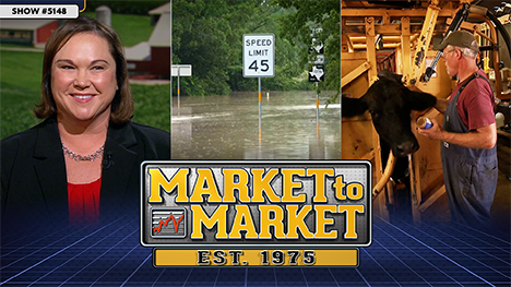
Heat domes, wildfires and random rains blanket the Grain Belt. Who will care for the herd? A look at the rural veterinarian shortage. And, commodity market analysis with Naomi Blohm.
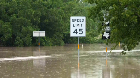
Flash flooding strikes Texas and Louisiana as Canadian wildfire smoke and extreme heat spread across the country—but what could the changing weather mean for crops?
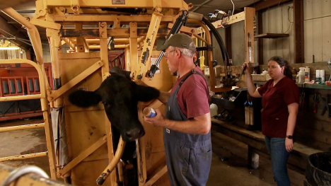
A growing shortage of veterinarians is leaving animal health care in rural America at risk.
Hard data backs up what American farmers have long been concerned about with Brazil. A squid squabble off the Oregon coast. And, commodity market analysis with Ted Seifried.