This week, the East Coast received an early blast of summer, with highs in Philadelphia reaching into the 90’s with the heatwave expected to continue through the weekend.


This week, the East Coast received an early blast of summer, with highs in Philadelphia reaching into the 90’s with the heatwave expected to continue through the weekend.
Transcript
This week, the East Coast received an early blast of summer, with highs in Philadelphia reaching into the 90’s with the heatwave expected to continue through the weekend.
Lauren Authur, Philadelphia resident: “Today is extremely hot. It honestly got hot sooner than we expected it to be.”
Across the nation, widespread drought worsened. Scattered rains in Texas lessened the drought slightly, but most of the state expanded its drought severity leaving the area in exceptionally dry conditions.
Portions of the corn belt received 2 to 5 inches of rain, while nearby areas remained dry with widespread precipitation deficits of over an inch.
Broad portions of the Wheat Belt remain in extreme or exceptional drought conditions.
Forecasters also believe that the upcoming hurricane season will see fewer named storms than average, due to a developing strong El Nino. Nine of the last 10 hurricane seasons have been graded as above average. Strong El Nino formations push dry air into the Caribbean, making the formation of strong storms more difficult.
For Market to Market, I’m Peter Tubbs.
contact: [email protected]
Watch More

New tariffs heighten U.S.-Canada trade tensions, USDA backs $10 billion in emergency farm aid, and cattle producers confront continuing market pressures.
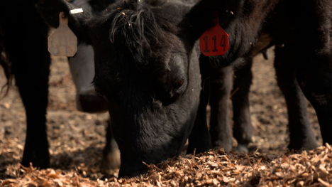
Despite historic cattle prices, many producers still aren't expanding their herds. White Oak Pastures owner Will Harris explains why.

Weather concerns, global conflict and renewed Chinese buying are supporting grain prices. Don Roose discusses whether corn could continue climbing and how producers should approach the market.

Weather concerns and global conflict are adding risk to corn and soybean markets. Don Roose discusses whether seasonal lows are in and how producers can protect prices without giving up potential gains.
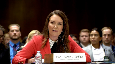
USDA Secretary Brooke Rollins supports $10 billion in direct aid for farmers facing high input costs and losses during the 2026 growing season.

President Trump announced new 50 percent tariffs on many Canadian imports, heightening trade tensions with America’s second-largest agricultural export market.